
Offshore geophysical surveys for engineering and subsea infrastructure.

UNISHORE performs geophysical surveys to gather the detailed data required by design engineers for the installation of offshore structures, subsea cables and pipelines.

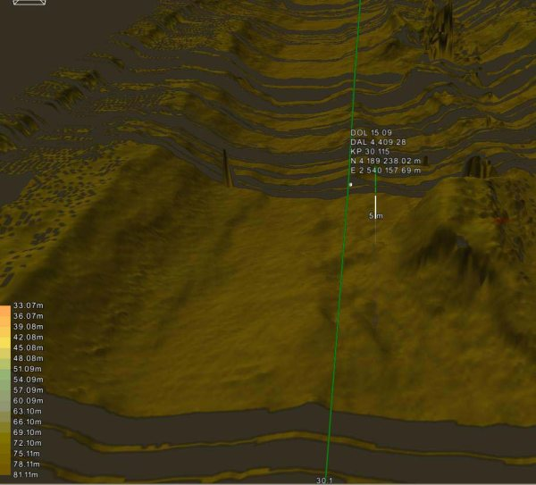
Multibeam visualisation of seabed relief

Offshore geophysical survey

The acquired data provides a detailed understanding of seabed morphology, sub-seabed conditions and geological features for risk assessment and geotechnical planning.

  • Mapping of seabed morphology and sub-seabed conditions
  • Profiling of geological features and units
  • Detection and assessment of geohazards
  • Seabed and sub-seabed reference for geotechnical investigations

Applications, equipment and deliverables.

Typical applications

Survey programmes are configured around the project type, operating environment and engineering requirements.

  • Site surveys for rigs and platforms
  • Offshore windfarm developments
  • Route surveys for pipelines, power cables and submarine fibre-optic cables
  • Geohazard and fault detection
  • High-resolution seismic mapping
  • Geochemistry studies

Geophysical survey equipment

Sensor selection and integration are adapted to the survey objectives, water depth and required resolution.

  • Multibeam and single-beam echo sounders
  • Analogue CHIRP sub-bottom profilers
  • Digital side-scan sonars
  • Magnetometers and gradiometers
  • Environmental sampling equipment

Deliverables

Deliverables are tailored to each client specific requirements and can be supplied in hard-copy and digital formats.

  • Factual, interpretive or combined reports
  • AutoCAD and PDF charts
  • GIS deliverables to the OGP/IMCA Seabed Survey Data Model (SSDM)
  • Client-specified geodatabase and schematic formats

Talk to us about your offshore geophysical survey requirements.

Our team can review the scope, operating conditions, equipment and deliverables required for the offshore campaign.

Request information